I spent August-November 2016 in the eastern end of the Altai Mountains in Ömnögovi Aimag, helping a Logantek Mongolia LLC geophysics crew to read a fixed-loop transient electromagnetic survey in some pretty rough terrain, and providing real-time reporting of results and interpretation to the client. We succeeded in locating a potentially significant extension to a prospect, which the client had intersected with one hole but had not recognized as being part of a large body.
The target of the survey was volcanogenic massive sulphide (VMS) mineralization occurring close to the contact between an andesite sequence and overlying sediments. The client, a Korean-owned company, had previously drilled structurally repeated mineralization at two prospects. The objective of our survey was to locate new targets along a strike length of about 9 km using 12 overlapping FLTEM surveys with 800 m x 800 m loops and 100 m spaced survey lines.

Our transmitter loops were energized with a Zonge GGT-30 transmitter powered by a ZMG-30 generator transported by a retired Mongolian military truck. Readings were taken using two Zonge receivers (GDP-16 and GDP-32) with Zonge TEM/3 induction coils measuring the in-line and vertical components of the response. Owing to the rugged, rocky terrain and high winds prevailing for most of the survey, sandbags (rice sacks filled with river gravel) were used to stabilize the coils.
Despite the difficult conditions, the crew was able to acquire adequate late-channel data over the entire survey area. Test measurements conducted at the commencement of surveying determined that a 4 Hz repetition rate would allow us to sample enough of the off-time decay to detect a moderately strong conductor, while also allowing us to stack sufficient cycles to produce an acceptable signal to noise ratio.
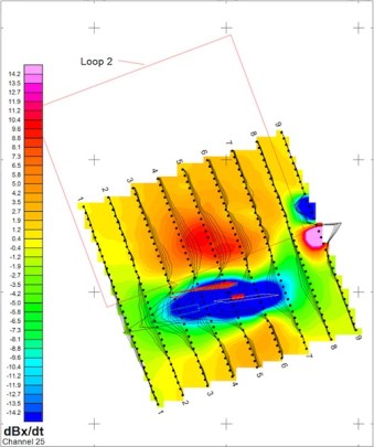
The in-line (x-component) FLTEM measurements define a negative peak above the top edge of steeply dipping conductors. One such response provided us with a surprise: it corresponded not to the main body of sulphide defined by drilling, but to a thin sulphide drill intersection located to the south, which the client had represented with a small block in the wireframe model. The interpreted conductor extended over about 400 m, representing a significant new target. The currently known mineralization produced a small inflexion on the anomaly profile caused by this new sulphide target.
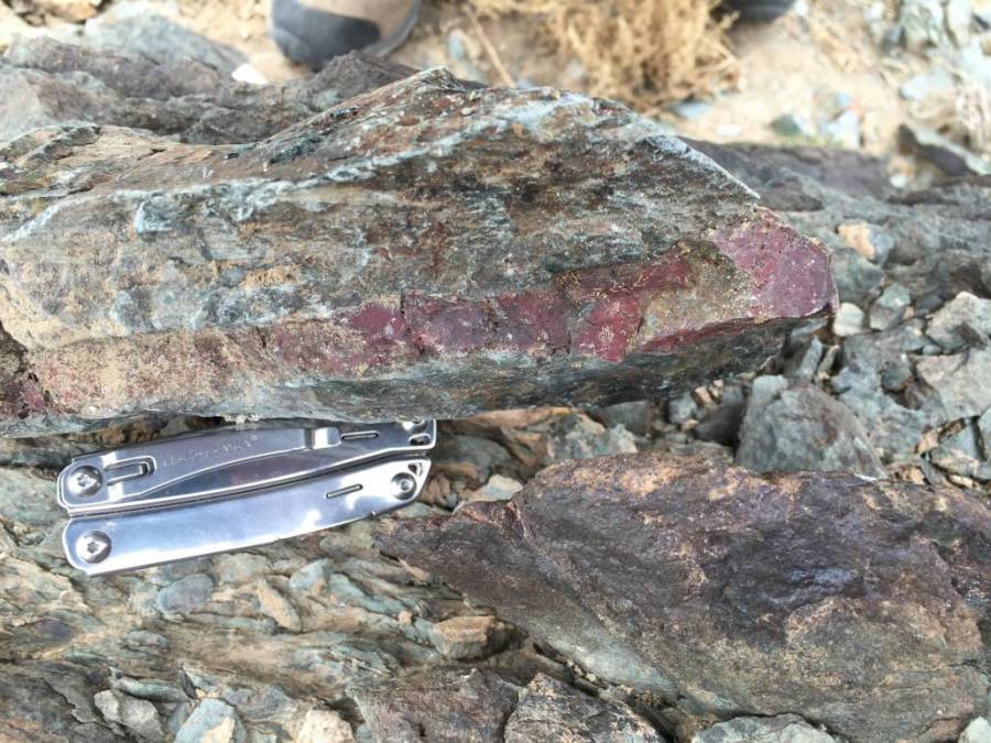
The survey did not locate any new targets outside the existing prospect areas, but did highlight a potentially important zone of mineralization whose significance had not been previously recognized. Detailed mapping to identify subtle expressions of hydrothermal systems (e.g. exhalative cherts, like the one I found poking around at the surface projection of one of the lodes) may facilitate more effective electromagnetic survey design in future geophysical campaigns.